Navigating the Market: The 2026 East Bend, OR Area Guide
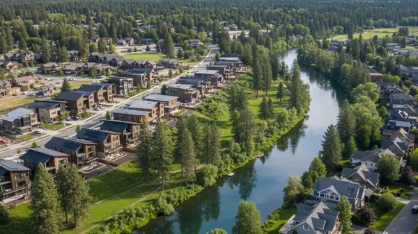
Central Oregon continues to draw buyers looking for immediate outdoor access and high desert living, and the eastern side of the city has become the primary engine for residential growth. While the west side often commands attention for its proximity to Mount Bachelor, the neighborhoods east of Highway 97 offer a distinct set of practical advantages. Buyers exploring this East Bend, OR area guide will find larger property footprints, extensive new infrastructure, and immediate access to major retail hubs.
With the city expanding its boundaries and investing heavily in southeast sector utilities throughout 2026, understanding this specific market is crucial for making an informed real estate decision. The area perfectly balances the rugged appeal of the Cascade Range with the daily conveniences required for modern living. Moving to this side of town means embracing a lifestyle where expansive parks, modern schools, and comprehensive medical facilities are always just a short walk or drive away.
An Overview of the East Bend Real Estate Market
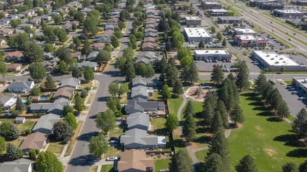
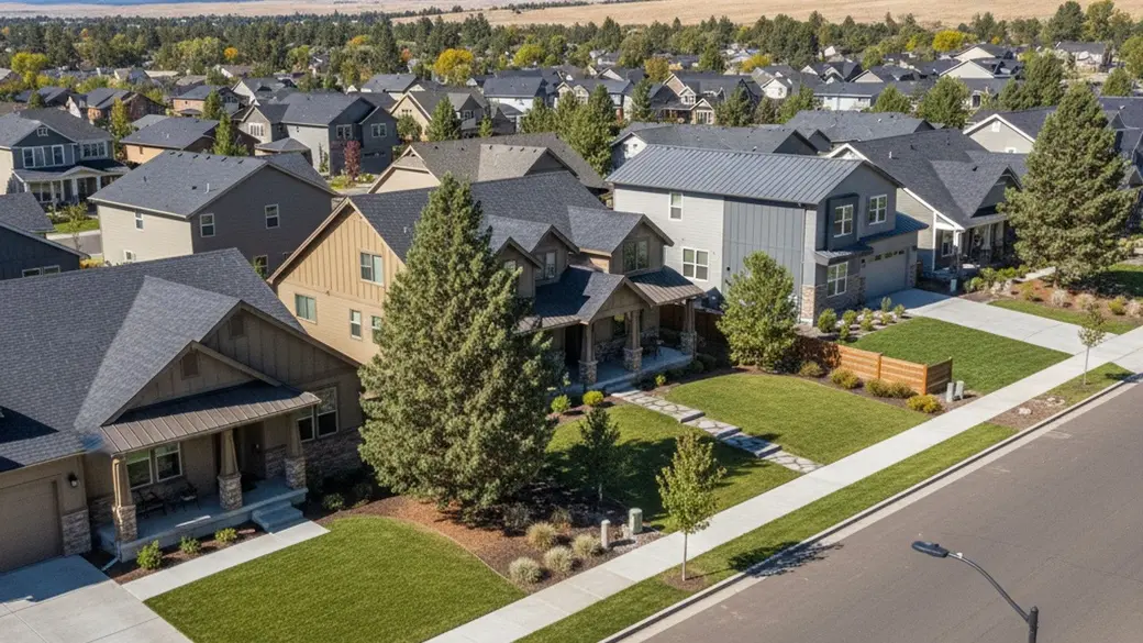
The housing landscape east of the Deschutes River provides a sharp contrast to the older, denser neighborhoods found downtown or near the Old Mill District. Buyers here generally find wider street frontages, traditional neighborhood grids, and properties that prioritize highly functional yard space. This layout provides a sense of breathing room that can be difficult to secure in the city's historic core.
As of Spring 2026, the median sales price across the broader Bend area hovers between $685,000 and $725,000. Properties in the eastern quadrants often align with or sit slightly below this median, presenting a compelling value proposition for those seeking more square footage per dollar. This pricing structure allows buyers to maximize their purchasing power without sacrificing access to premier city amenities.
The clear takeaway for today's market is that East Bend offers the most practical path to homeownership for buyers who prioritize property size and modern infrastructure over immediate proximity to the mountain.
Average Property Prices and Housing Types
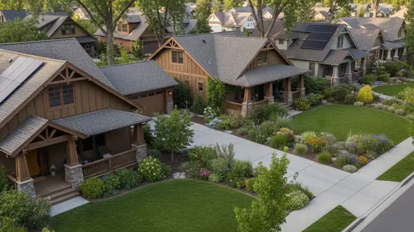
The architectural mix here leans heavily toward Craftsman-style single-family homes and modern townhouses featuring energy-efficient designs. Established neighborhoods typically feature lot sizes ranging from 0.15 to 0.25 acres, which allows for substantial backyards, garden spaces, and mature landscaping. These larger parcels are highly sought after by buyers who want private outdoor living areas.
With the average price per square foot sitting around $375, buyers can secure well-appointed properties that might command steep premiums closer to the river. The stabilization of mortgage rates near 6% this year has brought financed buyers back into this specific market segment. This renewed buyer activity is currently absorbing the recent 20% year-over-year increase in local inventory, creating a balanced and healthy market dynamic.
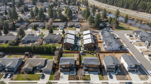
New Developments vs. Established Subdivisions
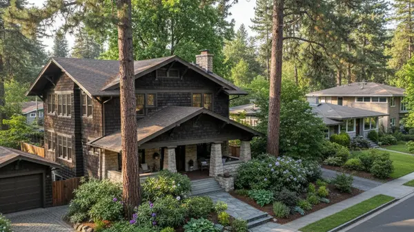
Mature subdivisions like Mountain View and the areas surrounding the Larkspur Trail offer established tree canopies and quiet, winding residential streets. These older pockets contrast sharply with the expansive master-planned communities currently transforming the southeast corner of the city. Blending these two distinct housing styles gives prospective buyers a wide spectrum of choices within a single geographic zone.
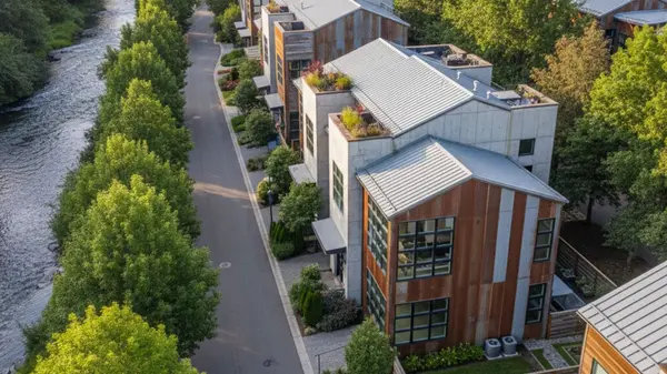
Major 2026 projects like the 119-acre Easton development are bringing hundreds of new homes to the market, integrating mixed-use commercial spaces directly into residential grids. These newer tracts around Stevens Road feature smaller individual lots but compensate with extensive dedicated community parks and paved trail connections. Buyers looking for turnkey properties with modern warranties will find abundant options in these active construction zones.
Parks and Recreation Amenities in East Bend
Outdoor recreation is a foundational element of the Central Oregon lifestyle, and the eastern half of the city maintains a robust network of green spaces. Residents do not need to navigate cross-town traffic to the Cascade Lakes to find meaningful outdoor activities and scenic viewpoints. The local municipality has prioritized land preservation, ensuring that nature remains highly accessible to every subdivision.
City planners have successfully integrated the natural high desert terrain - characterized by juniper trees, sagebrush, and volcanic rock - into the municipal park infrastructure. The result is a collection of recreational facilities that feel distinctly tied to the local geography while offering modern, well-maintained amenities. These public spaces showcase the rugged beauty of the region right in the middle of residential zones.
For active buyers, the sheer density of meticulously maintained public parks makes the eastern neighborhoods a highly practical choice for daily outdoor routines.
Pilot Butte and Pine Nursery Park
Pilot Butte State Scenic Viewpoint stands as a central landmark, offering both paved and dirt hiking trails that climb nearly 500 feet in elevation. Reaching the summit rewards hikers with panoramic, 360-degree views of the Cascade Range and the entire city layout below. It serves as a daily fitness destination for locals and a stunning backdrop for the surrounding neighborhoods.
Further north, the 159-acre Pine Nursery Park serves as a massive recreational anchor for the community. The facility features extensive pickleball courts, sports fields, fishing ponds, and sprawling off-leash dog park areas that see heavy daily use. This park acts as a central gathering point for residents seeking structured sports facilities and open green spaces.
Local Trail Systems and Green Spaces
The Bend Park and Recreation District maintains miles of multi-use paths that weave seamlessly through the eastern residential zones. The Larkspur Trail is a standout feature, creating a pedestrian highway that connects quiet housing tracts directly to commercial centers and community facilities. This trail system allows residents to commute, exercise, and run errands without relying on a vehicle.
This emphasis on paved multi-use paths significantly boosts the overall walkability of these neighborhoods. Cyclists also benefit from quick access points to expansive mountain biking and gravel riding networks located just beyond the eastern city limits. The transition from paved city paths to rugged dirt trails is incredibly fast for those living on this edge of town.
Bend-La Pine Schools Serving East Bend
The Bend-La Pine School District operates as the primary educational authority for the region, managing a student population of roughly 17,000 across Central Oregon. The district has heavily invested in the eastern portion of the city to keep pace with rapid residential expansion and changing demographic needs. These investments ensure that infrastructure scales appropriately with the influx of new housing developments.
Zoning in this area distributes students among several distinct campuses, ranging from established neighborhood elementary schools to state-of-the-art secondary facilities. The district also incorporates specialized magnet programs and dual immersion language options into its broader curriculum. This variety allows residents to access tailored educational pathways without commuting to distant parts of the city.
Buyers evaluating long-term property holds will find that the recent construction of modern educational facilities in the southeast quadrant strongly supports future property valuations.
High Schools and Educational Facilities
Mountain View High School and Caldera High School serve as the two primary secondary campuses for the eastern residential zones. Caldera High School, the district's newest facility located in Southeast Bend, features advanced technology centers and modern athletic fields designed to support the surrounding new construction tracts. These modern amenities reflect the district's commitment to providing high-quality resources in rapidly growing neighborhoods.
The middle and primary educational tiers are anchored by well-integrated campuses like High Desert Middle School and Bear Creek Elementary. These facilities are strategically placed within residential grids to minimize commute times and encourage walking or biking to campus. The thoughtful placement of these schools helps reduce morning traffic congestion across the local road network.
Commercial Hubs and Healthcare Access
A major advantage of living east of Highway 97 is the high concentration of retail centers and essential daily services. The commercial zoning here is robust, meaning residents rarely need to cross the Deschutes River or navigate downtown traffic for routine errands. This localized convenience is a massive draw for buyers who value efficiency and easy access to necessities.
The landscape features a practical mix of large grocery chains, big-box retailers, and independent dining options clustered along major arterial roads. This commercial density provides a level of daily convenience that is sometimes lacking in the more remote or topographically challenging western neighborhoods. Everything from home improvement stores to boutique coffee shops can be found within a short driving radius.
The self-sustaining nature of the east side commercial sector is its strongest selling point, offering a highly efficient lifestyle for busy residents.
The Forum Shopping Center and St. Charles Bend
The Forum Shopping Center, located conveniently off Highway 20, operates as the primary retail engine for the immediate area. It houses major grocery anchors, warehouse clubs, and a variety of retail storefronts that handle the bulk of local shopping needs. The ample parking and centralized location make it a frictionless stop for residents tackling their weekly errands.
Just north of this retail hub sits St. Charles Bend, the largest hospital and the only Level II trauma center in Central Oregon. Located off Neff Road and Medical Center Drive, this expansive medical district drives significant local employment and spurs continuous infrastructure upgrades. The presence of this major healthcare facility provides peace of mind and anchors the local economy.
Transportation Infrastructure and Commuting
Navigating the eastern half of the city relies on a fairly traditional grid layout intersected by several major arterial roads. The city utilizes an extensive network of roundabouts to manage traffic flow, a system that keeps vehicles moving efficiently without the idle times associated with traditional traffic lights. This approach to traffic management significantly reduces the stop-and-go congestion common in growing municipalities.
The City of Bend recently directed a $26 million investment into sewer and transportation infrastructure specifically targeting the southeast quadrant. These upgrades are actively alleviating bottlenecks and preparing the road network for the influx of new residents moving into the 2026 master-planned communities. The local government's proactive stance on infrastructure development is visibly transforming the streetscapes in this sector.
While construction delays are a temporary reality, the proactive expansion of east-side roadways ensures that long-term commute times will remain highly manageable.
Highway 20 Access and Transit Routes
Highway 20 serves as a crucial east-west corridor, providing a direct route out to the high desert toward Burns or funneling traffic west toward Highway 97. Utilizing these main arteries, a typical commute from an eastern subdivision into Downtown Bend usually takes just 10 to 15 minutes under normal conditions. This quick access allows residents to enjoy downtown amenities without dealing with central city parking on a daily basis.
For those seeking public transportation, the Cascades East Transit system operates several bus routes through the area. These routes effectively connect the residential zones to the major commercial hubs, the central medical district, and broader regional transit networks. This public transit layer adds an important level of accessibility for residents who prefer not to drive.
Frequently Asked Questions About East Bend
What is the cost of living in East Bend, Oregon, including housing?
The cost of living here is generally driven by housing, with area median home prices hovering around $685,000 to $725,000 in 2026. Because properties on the east side often feature lower price-per-square-foot metrics than the west side, buyers can stretch their housing budgets further. Daily expenses like groceries and utilities remain consistent with the broader Central Oregon regional averages.
How much snow does East Bend get in the winter?
The area typically receives about 20 to 30 inches of snow annually, though accumulation varies by specific elevation and neighborhood topography. Because the eastern neighborhoods sit slightly lower and are more exposed to the high desert sun, snow tends to melt off driveways and roads faster here than in the heavily treed western foothills. The city maintains active plowing routes along all major eastern arterial roads to ensure winter accessibility.
Where can I find new homes for sale in East Bend?
The highest concentration of new construction is located in the southeast quadrant, particularly around the Stevens Road tract. Master-planned communities like the 119-acre Easton project are currently delivering hundreds of new single-family homes and townhouses to the market. Buyers should focus their searches south of Highway 20 to find these modern developments and newly paved subdivisions.
Categories
Recent Posts